

About Mogila
Mogila Municipality
Mogila Municipality — a municipality in the Pelagonian Region, in southwestern Macedonia. It was created with the territorial division of 1996, and with the new territorial organization foreseen by the law of 2004, the Municipality of Dobrushevo was added to the former municipality of Mogila.

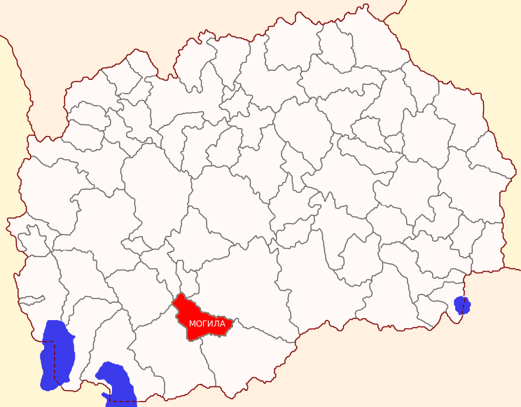
Geography
Mogila lies in the Pelagonian plain, mostly south of the river Shemnica, that is, between the old Bitola-Prilep road (now regional road R-106) and the Black River at an average altitude of 583 m. The municipality of Mogila is a medium-sized rural municipality, covers an area of 251.2 km2 and is located in the southwestern part of R. North Macedonia.
According to the absolute altitude, it is included in the municipalities with slightly below average values in the country. In fact, the territory of this municipality occupies space in the central parts of the Bitola Field, and the settlements are distributed in the catchment area of Crna Reka and the lower reaches of its right tributary Shemnica and lie in their alluvial parts.
It has a northwest-southeast stretching direction. From the north it borders the municipalities of Demir Hisar, Krushevo and Krivogashatani, from the east and southeast with the municipalities of Prilep and Novaci, from the south and west with the municipality of Bitola.
It has a fairly good geographical position and traffic connection, because the E-106 highway and the Bitola-Prilep railway pass through its central part. Also, from the large city center of Bitola, the central settlement of Mogila is located at a distance of only 10 km.
The total territory of the municipality covers 22,363 ha, and it consists of the cadastral municipalities of 23 villages, namely:
-Mogila = 2571.39 ha, -Beranci = 2018.52 ha, -Vasharejca =706.81 ha, -Gorna and Dolna Charlia =1089.06 ha, -Dolno Srpci =2371.16 ha, -Ivanjevci =1725,72 ha, -Loznani =906.94 ha, -Novoselani =534.19 ha, -Podino =629.82 ha, -Radobor =860.31 ha, -Sveto Todori =1118.31 ha, -Trnovci =1165.51 ha, -Dobrushevo =1649.16 ha, -Dedebalci = 1207.88 ha, -Musinci =1157.55 ha, -Noshpal =1047.80 ha, -Mojno =1335.90 ha, -Alinci =394.22 ha, -Puturus =645.20 ha, -Crnicani =1251.59 ha, -Trap =622.68 ha, -Budakovo =562 ,69 ha, Total in Mogila municipality = 22363.7 ha
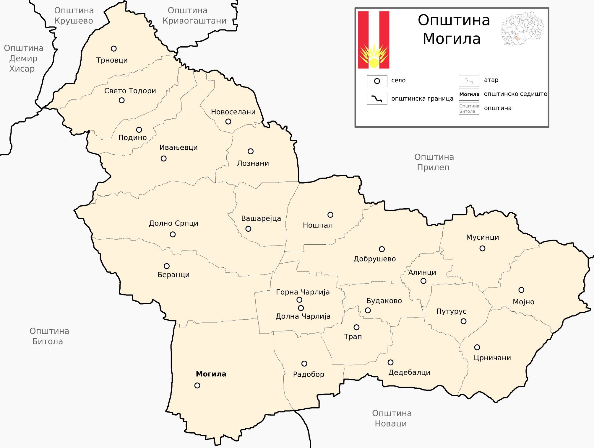
Distance of inhabited places in the municipality of Mogila from the center of the municipality. Mound.
Mogila: Alintsi 11 km, Berantsi 10 km, Budakovo 9 km, Vasharejca 12 km, G. and D. Charlia 7.5 km, Dedebaltsi 11 km, Dobrushevo 12.5 km, D. Srpci 13 km, Ivanjevci 16 km, Loznani 15 km, Mojno 21.5 km, Musinci 18 km, Noshpal 15.2 km, Novoselani 18 km, Puturus 15 km, Podino 21 km, Radobor 5 km, Sv. Todori 22 km, Trap 8 km, Trnovci 24 km, Crnicani 16 km.
Demographics
Note: The data refer to the settlements in Mogila Municipality according to the administrative division of 2004.
**Note: Data taken from the State Statistics Office, according to the official results of the census conducted in 2021.
Source: State Statistics Office of the Republic of North Macedonia
Climate
From a thermal point of view, Pelagonia has a modified moderately continental climate with distinct annual seasons. Winter is wet and cold, and summer is hot and dry. Autumn is significantly warmer than spring and the transition from winter to summer is faster than the other way around. The average annual amount of sunshine in Pelagonia is 2332 hours. The average annual temperature is 11.5 ºС. The average annual maximum temperature is 17.4 ºС, and the average annual minimum is 5.3 ºС.
Rainfall is a full reflection of the Mediterranean climate influence of this element. The summer months have little precipitation, and the late autumn months are the wettest. Precipitation is mostly from rain, an average of 70-80%, and snow is limited mainly in the winter months.
The frost period is long-lasting, on average it starts in October and ends in May, but the actual number of frost days is significantly less than the days of the average frost period.
On average, 610 mm of rain falls in Pelagonia annually. Winds are mainly from the north and south, and less often from the other directions.
The lack of precipitation and moisture in the summer period is compensated to a large extent by the hydromelioration system of Pelagonia – the irrigation system.